ETL Connector for ODK
  • Introduction
  • Connection
  • Data Preview
  • Data Import
  • Data Update
  • References
Powered by GitBook
On this page
  • Import data in GPKG and SHP
  • Import data in CSV

Data Import

PreviousData PreviewNextData Update

Last updated 2 years ago

The data import tab gives the possibility to import the request data into QGIS in the GeoPackage (gpkg), ESRI Shapefile, and CSV file depending on the configuration parameters.

Import data in GPKG and SHP

The data export can be done in either geopackage or Esri Shapefile. If the longitudes and latitudes are found in distinct columns, then the columns can be indicated directly, but if they are found in just one column, the single column geometry button () should be ticked and the column () to be used selected. The coordinate system also should be indicated using the button.

Once the processing is done, the data is loaded into the interface by default. If loading the data is not required, the load data box can be unticked.

Import data in CSV

If the data does not have geocoordinates or if the data is needed in csv format, the No Geometry box should be checked (). The result is then added as a table into the QGIS layer pane.

Data export.
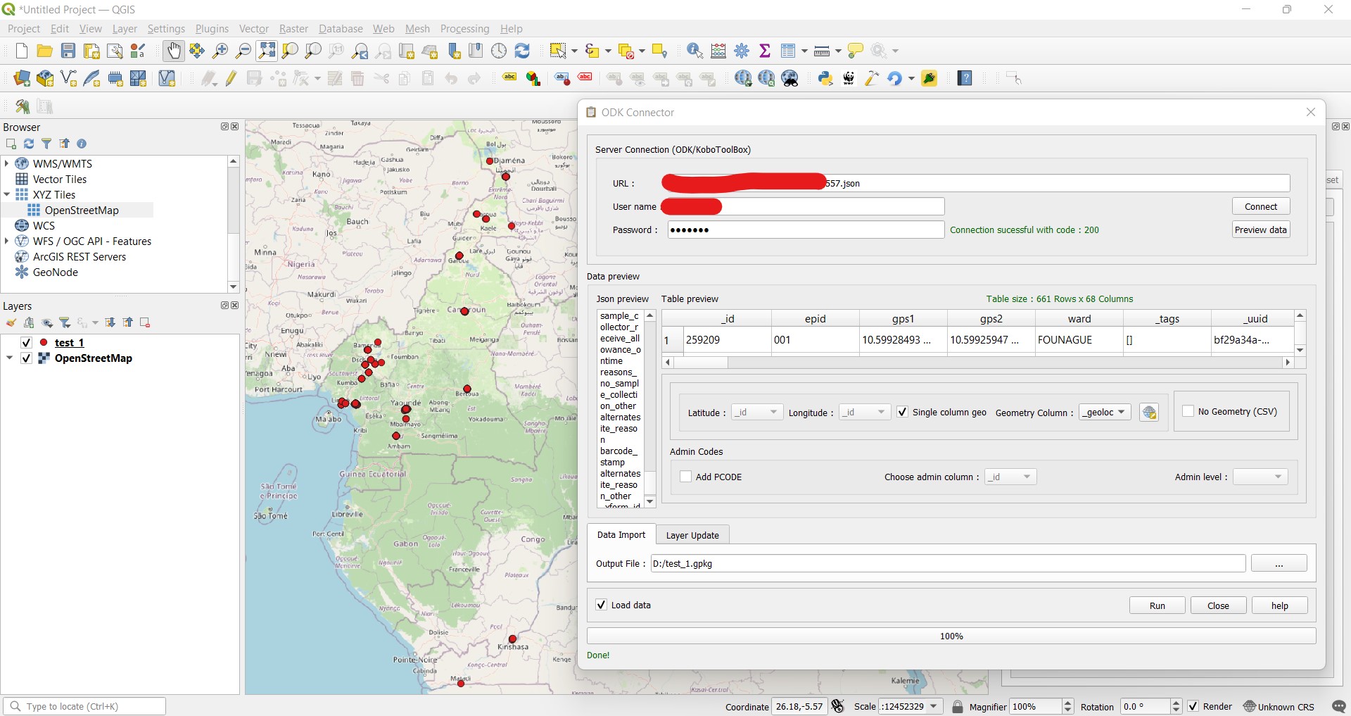
Processing and loading data into QGIS Interface
csv data import